- Community Consultation
Coastal Hazard Adaption Plan Community Feedback
Council is seeking your input: Coastal Hazard Risk Assessment.
DC Elliston is undertaking a coastal hazard assessment for Elliston, Venus Bay and Port Kenny. The two hazards under consideration are sea flooding and erosion. The project has been funded by the SA Local Government Association through the Climate Ready Coasts program and will be undertaken in two main stages:
- Stage 1 – understanding current and future coastal hazard risks (this project).
- Stage 2 – a coastal adaptation and monitoring plan (future project).
Mark Western from Integrated Coasts has been engaged to manage the first stage of the project.
Understanding coastal risk
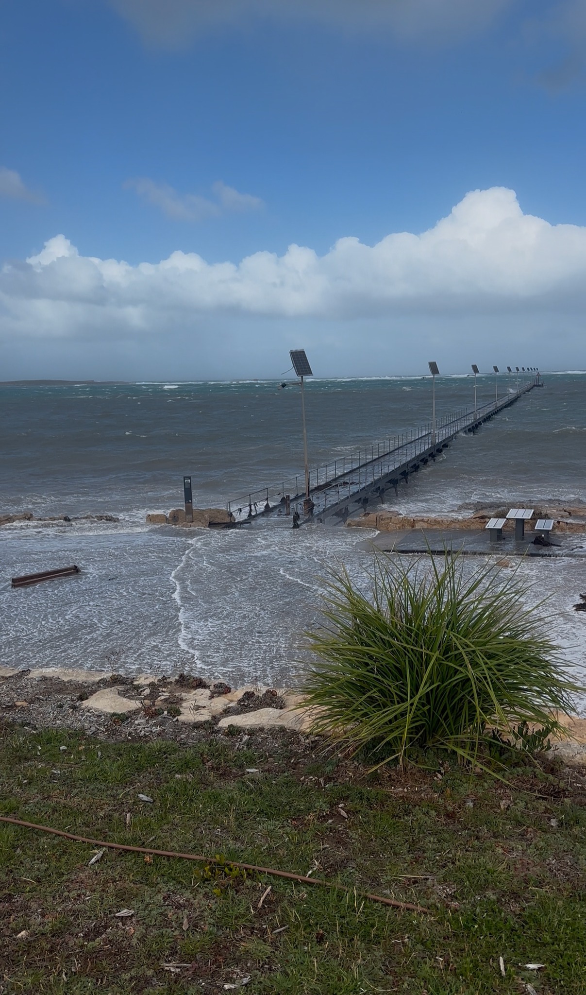
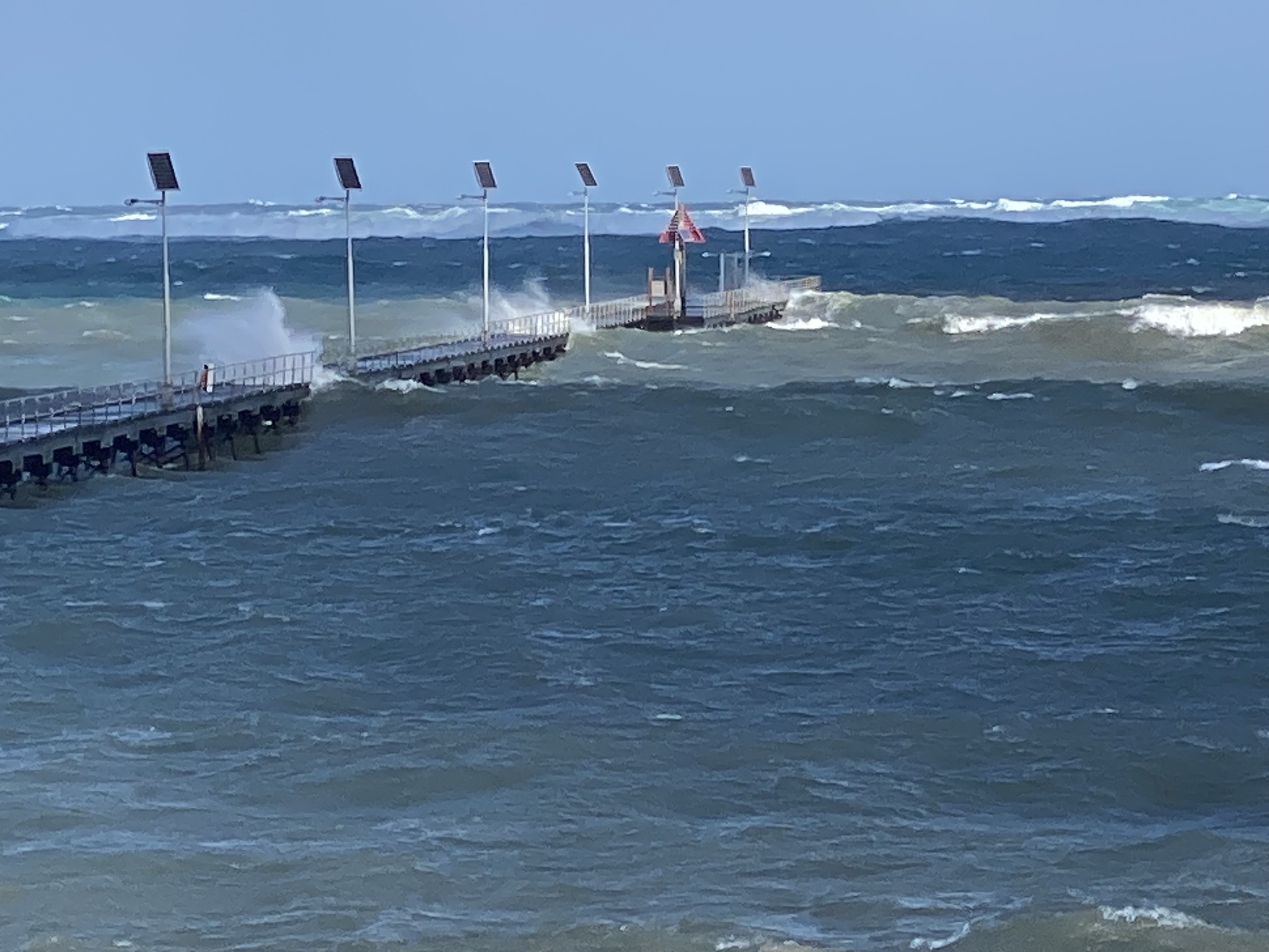
One way we can gain an understanding of our coastal risk is to review the impact of sea storms or erosion events from the past. For example, 1981 was a stormy year around our State with two major storms which also caused damage in the region. This current year of 2025 was similar to 1981 with two major storms occurring in May and June, with damage to the Elliston jetty as a result.
When considering future risk, we know that seas have been rising steadily for at least 170 years, and this trend is unlikely to reverse. Scientists who contribute to the Intergovernmental Panel on Climate change predict that the rate of sea level rise will increase in the future due to a warming climate. Understanding our current risk will assist in planning for the long-term benefit of the community whether the rate of rise remains relatively low or the rate of rise increases as predicted.
Your input is important
Local knowledge is valuable, and we encourage your input. First, you can provide photographs and/or anecdotes of previous storm events. The most useful photographs are those that show water levels along the coast. For example, if we can establish the water level at places such as a boat ramp, beach, or adjacent a road or other flat surface, we can use a digital elevation model to estimate the height of the sea-flood at those locations. We can then add various rates of sea level rise to ascertain the long-term risk. Second, we encourage you to complete a survey to convey your experiences of the coast. Have you observed any changes or has the coast remained stable? We are just as interested in either finding, so please contribute whatever your experience has been.
How to provide photographs and or storm anecdotes:
- Email them to dce@elliston.sa.gov.au. It is very important that you include the date and time that the photograph was taken.
- Bring the photographs to the Council office at 21 Beach Terrace, Elliston. If photographs are in hardcopy, these can be scanned at the office.
- Contact the consultant directly at mark.western@integratedcoasts.com.
- Provide them when completing the survey below.
How to provide feedback about coastal change:
- Complete the survey
- or via QR Code:

Next steps
Next year (February, 2026) we will report the findings of the study for your review and Mark Western will visit the region to undertake a site review and to provide additional points of contact with you so that you can provide further feedback (details to come).